
It is always fun to see historical maps of the places our ancestors lived. Many historical maps of Denmark have been digitized and can be accessed online free of charge. In this post I will demonstrate how you find a map of the parish your Danish ancestors lived in.
Historical Maps Online / Historiske kort på Nettet
The website with the digitized maps is called Historiske kort på Nettet (historical maps online). The menu consists of seven tabs at the top of the page:
- Cadaster maps
- Parish and hundred maps
- Financial maps
- Topographic maps - nationwide
- Topographic maps - regional / others
- Sea maps
- Record books
Today I will focus on the parish maps, but I promise to demonstrate the cadaster maps and record books in a later post.
Danish Parish Maps
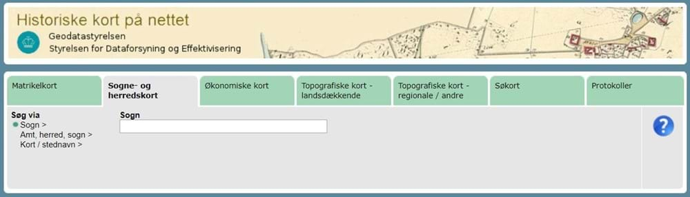
Above is a screenshot from the page with sogne- og herredskort (parish and hundred maps). To the far left is a small menu where you can choose your search method:
- Sogn (parish)
- Amt, herred, sogn (county, hundred, parish)
- Kort / stednavn (map / place name)
The green dot shows which option has been chosen and the text boxes change when the search method is changed. Searching via a map may seem tempting, but I find that writing the name of the parish is a lot easier. Not all options exist for all types of maps. Try the various options and see what you like best.
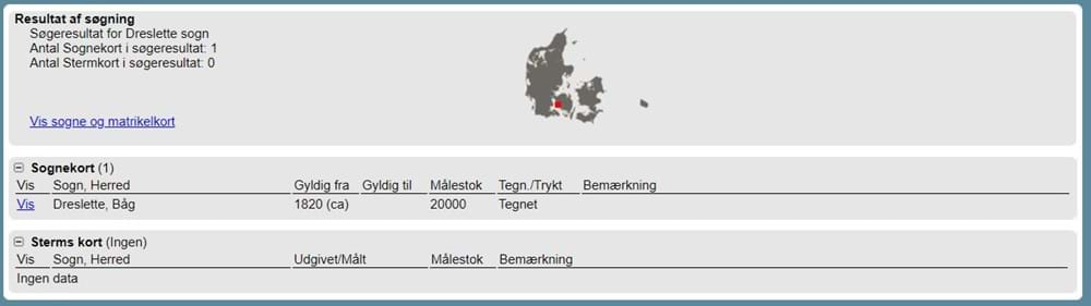
I want to find a map of Dreslette Parish, where Anders Madsen owned a lot as described in a previous post. When you type in the text box, a list of suggestions appears. The search result for Dreslette shows one map from about 1820. The search results are divided into types of maps, in this case sognekort (parish maps) and Sterm's maps of which there aren't any for Dreslette, because they only cover Copenhagen City. Above the list of maps is a small map of Denmark with an even smaller red dot which indicates where in Denmark the parish lies. There is also a link named Vis sogne og matrikelkort. If you click that link, you will open a new window with the parish and cadaster map which is valid today. To open the parish map from about 1820, click the link named Vis (show) to the far left on the line listing the map in the search result. The map opens in a new window.
Enlarge the window with the map. The maps have been scanned in high resolution, so you may have to patient for it to fully load again. In the upper right-hand corner of the window with the map, you can change navigation method by clicking the symbols:
- Magnifying glass with a plus sign: Zoom in
- Magnifying glass with a minus sign: Zoom out
- Four-way arrow: Pan the map
- Two-way arrow forming a circle: Turn the map
- Globe: Show the entire map
When you want to zoom in or out, you click the map, hold in the mouse button and drag to make a square. When you want to pan the map, you click the four-way arrow and drag the map in the desired direction. Once you let go of the mouse button, the map needs to fully reload, before you can interact with it again.
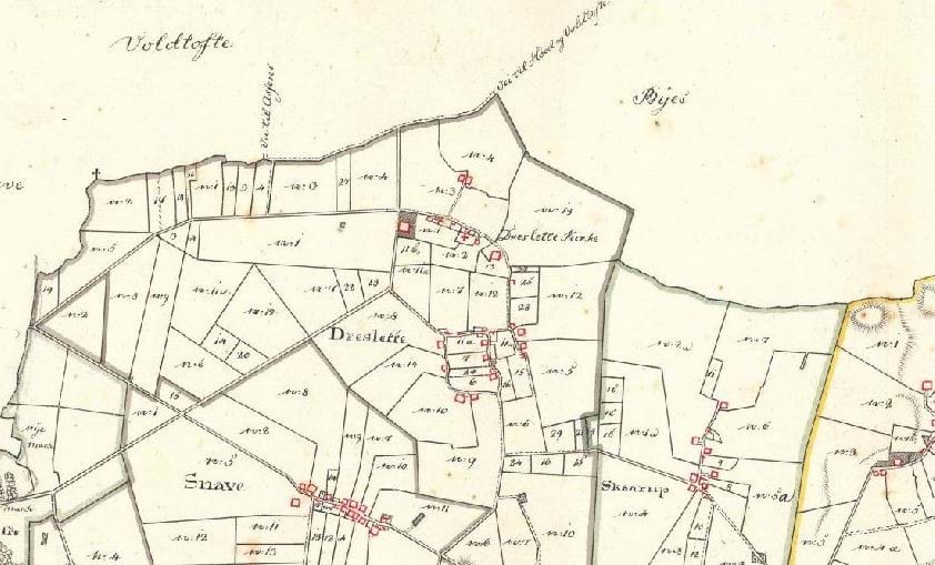
Each parish covers several ejerlav (property areas). The thick lines in different colors are the boundaries between the ejerlav. If you open the full map, you can see a long arrow in the right-hand side of the map. The arrow points towards north, so in this particular map north is up. However, that is not the case with all these historical maps, so if you are trying to compare the roads to today's map, you may find it useful to turn the historical map so that up is north.


